
Lofty Alpine County, California
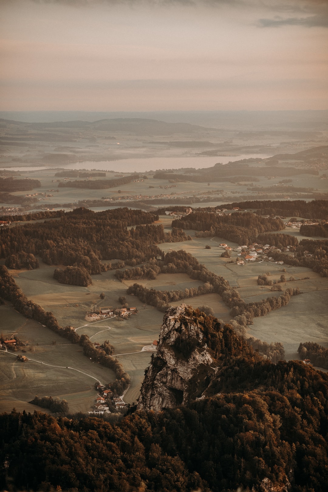
The highest county in California provides visitors with panoramic views of rocky mountains, lush valleys, and tranquil lakes, as well as the host of trails that lure the adventurous to follow them.
Counties that encompass the southern Sierra Nevada mountains in California may have the highest peaks, but no county in the state has a higher average elevation than aptly named Alpine County. Although four of its mountain passes are crossed by highways (two of which are closed in the winter), Alpine still consists primarily of forest, meadows, and rocky peaks. In fact, it’s much like it was when Kit Carson crossed the mountain pass that now bears his name on his way into California.
By taking California highways 88 and 4, you can travel a loop through Alpine County that begins and ends in Stockton. Near the county line, you’ll pass the popular Kirkwood Ski Area and reach 8,500-foot Carson Pass. This pass is filled with history. Kit Carson accompanied Captain John C. Fremont and his expedition over this pass bound for Sacramento as the party completed the first winter crossing of the Sierras, in February 1844. Today, a monument to Fremont and Carson stands at the pass, as does a replica of a tree section into which Kit Carson carved his name and the date.
Another monument here honors Norwegian-born John “Snowshoe” Thompson, who should be the patron saint of postal workers. Thompson was a hardy mail carrier who skied (skis were called snowshoes in those days) over the Sierras, including Carson Pass, to get the mail through. He never failed - even during blizzards, and even though his load sometimes amounted to 100 pounds. He delivered mail from 1856 to 1876, twenty years of his life, for which his promised salary was never paid.
Carson Pass is used heavily by hikers and by cross-country skiers in the winter and with good reason. Two heavy-duty scenic trails - the Pacific Crest Trail and the Tahoe-Yosemite Trail - pass through here. As they head south, both of these trails zigzag through granite outcrops and mountain hemlock for a 1/2 mile before reaching Frog Lake. Watch for the broad, cheery flower heads of mule ears (a member of the sunflower family) around this lake early in the season. The trail continues on through a mix of meadows and conifer clusters, where gray, black, and white Clark’s nutcrackers swoop from tree to tree. From a trail junction near Elephant’s Back, the Tahoe-Yosemite Trail heads straight toward Winnemucca Lake and on into the 150,000-acres Mokelumne Wilderness. The wilderness trail plunges steeply into Summit City Canyon, passing a little jewel called Fourth of July Lake on its way to the bottom. You’ll need a Forest Service permit to hike this trail.
The Pacific Crest heads left, skirting the base of the brownish volcanic deposits of the Elephant’s Back and dropping down the eastern slope of the crest. Much of the Sierran crest in Alpine County is granite overlain by more recent volcanic deposits. Glaciers covered most of the landscape in the geologic past, so the lakes are usually set in granite basins. Many of the peaks are volcanic.
From the pass, Highway 88 drops steeply down the east slope overlooking Red Lake. The second turnoff on the right, Blue Lakes Road, leads out to the Hope Valley Campground and on to the Blue Lakes. The pavement soon becomes washboardy dirt, and the road becomes narrow and twisty in places. Somehow good-sized motor coaches manage to get back in here at the area’s campgrounds and in scattered undeveloped sites, despite the condition of the road. The lakes are set in a patchwork of pines, aspens, and granite amid looming peaks of the prevalent volcanic deposits.
As you follow the narrow West Carson River Canyon, turn right toward Markleeville at the historic town of Woodfords. On your way there on highways 89 and 4, turn left on the Airport Road, and drive one mile to the Curtz Lake Environmental Study Area. Three short, self-guiding trails, to moderately dense, coniferous forest; open grasslands; and lakeshore provide an education on the geology and ecology of this area, as well as an enjoyable introduction to the natural history of Alpine County. Among other things, the trails introduce hikers to the vanilla-odored bark of the Jeffrey pine, and to the single-leaf pinyon pine, which is still sought by the local Washoe Indians for its large, tasty pine nuts.
From Markleeville, travelers can drive three miles to Grover Hot Springs State Park. This park not only offers pine-shadowed campgrounds and hiking trails but also a pool area where hikers and weary travelers can luxuriate in 102- to 106-degree Fahrenheit (about 40-degree Celsius), mineral-rich water, alternating with the bracing plunge into an unheated pool. Although its hours vary with the season, the pool area is open year-round. The hot pool is especially inviting after a wintry day of cross-country skiing.
Less than a block before you rejoin the highway on your way back to Markleeville, you can turn left onto Museum Street and climb a hill to a historical complex that overlooks the town. Operated by the Historical Society of Alpine County, the complex consists of the town’s Old Webster School, which was in use from 1883 to 1929; the old jail containing 100-year old iron jail cells from Silver Mountain City; and a museum full of artifacts. Among the museum’s displays are a pair of skis and a certificate of citizenship belonging to Snowshoe Thompson himself, plus an enlargement of an old newspaper article about him.
At the Forest Service visitor center in town, travelers can learn about rafting opportunities on the East Fork of the Carson River. A takeout point is situated a short distance south of town. If you don’t have a raft of your own, then you can float with a number of private rafting companies. Sorensen’s Resort in Hope Valley can make reservations for rafting trips for you. Several companies offer raft trips on the Carson River; the easiest way to hook up with one is to search for East Fork Carson River rafting in your web browser.
After Highway 89 heads off toward Monitor Pass, you’ll pass the gates that keep the higher elevations of Highway 4 closed through the winter. The road continues past the gates along the East Fork Carson River until it reaches the historic site of Centerville. Near here, you can turn left onto Wolf Creek Road. After driving 3-1/2 miles, you’ll reach a fork. Take the left road of the fork and drive to the north end of Wolf Creek Meadows. Then, after 2/3-mile, you’ll reach a spur road that climbs to the trailhead for the High Trail and the East Carson River Trail, which is also called the Low Trail.
Soon after you reach this point, this relatively uncrowded road takes on its high-country character. In the words of a friend of mine, “it used to be a deer trail until they narrowed it.” As such, drivers of large coaches will probably want to turn around at this point. However, the road can accommodate mini-motorhomes and Class A vehicles up to 25 feet in length, assuming that their drivers are up to the challenge.
The High Trail and the East Carson River Trail lead into one of California’s designated wilderness areas - the 160,000-acre Carson-Iceberg Wilderness - and into the East Carson River Canyon, which is one of the longest and deepest canyons east of the Sierran crest. The canyon has been carved by glaciers up to 19 miles long.
As you continue along Highway 4 next to Silver Creek, the road becomes very narrow. Small coaches that make the climb up to the Silver Creek Valley will cross the bridge over Raymond Creek, and passengers will gasp at the sight of Raymond Creek Falls upstream. Just past a sharp bend up ahead, two Toiyabe National Forest campgrounds spread out on both sides of the road.
As the highway snakes its way up from the campgrounds past aspen groves, it passes several primitive campsites. These are little more than dirt driveways leading out to rock fire rings. In fact, much of this high country provides primitive sites for the taking. A few favorite campsites are situated in this Silver Creek area. Next to a small creek with aspens and willows all around, the traveler can enjoy a broad view of the valley from the top of a bare hill. The sound of rushing water lulls you to sleep at night. The chilly creek has carved smooth contours into the granite.
After you pass the Kinney Reservoir and probably a number of anglers, you’ll once again reach trailheads for the Pacific Crest Trail, just before the 8,730-foot Ebbetts Pass. If you take the first trailhead, you’ll head south, climbing a ridge and curving along a slope toward Nobel Lake, which you’ll reach after about 4 miles. Nobel Creek is well-stocked with California’s state fish, the golden trout. If you choose the second trailhead, you can climb to an overlook that takes in the highway and Kinney Reservoir, and then continue north past Ebbetts Peak and some small ponds and lakes toward Upper Kinney Lake. This stretch is less than two miles long.
Continuing westward, you’ll cross the Pacific Grade Summit at 8,050 feet and negotiate more hairpin turns on your way to the major recreational attraction along the Stanislaus National Forest portion of Highway 4. At 7,320 feet, pine-shrouded Lake Alpine is 50 miles from the town of Angels Camp. Motorboating is popular here and the Department of Fish and Game has stocked the lake with rainbow trout. Around the lake itself, trails lead to two volcanic ridges - Osborne Point on the western side and Inspiration Point from the southeast. Four developed campgrounds offer sites for campers. These facilities and picnic areas are usually open from June 15 to October 15 only, because Highway 4 isn’t plowed during the winter months from this point east.
The Tahoe-Yosemite Trail runs next to the eastern end of the lake. To head south on this 186-mile hiker’s trail, you would start at the east end of Silver Valley Campground. After you’ve walked about a mile up and down over the low ridge, you’ll reach a meadow at Duck Lake on the border of the Carson-Iceberg Wilderness. Rock Lake, a shallow, marshy body of water provides a warm swim, is farther on if you’re up to the 4-1/2 -mile hike from Lake Alpine. The Mokelumne Wilderness is about four miles north of Lake Alpine on the trail.
Even though the Ebbetts Pass area is closed in the winter, another of California’s more popular ski resorts, the Mount Reba Ski Area, swings into high gear. Alpine County is truly an unspoiled, year-round recreation land. Even a mostly dry-reading plan for the county transportation waxed poetic about this place saying, “life here is a dedicated involvement with nature.” For those who are interested, it’s also a dedicated involvement with history.
Alpine County’s official website: http://www.alpinecounty.com
Toiyabe National Forest website: https://www.fs.usda.gov/htnf/ then go to the Carson Ranger District, which covers the area east and south of Lake Tahoe.
For more information, view our website at: [http://www.robinsontwins.com]
and our online photo gallery at: http://www.RobinsonTwins.blogspot.com